
Cozy Cabin Waterville Estates Guidebook
Food scene
Their pizza and calzones are delicious. Lots of soft dough and tasty sauce.
10 명의 현지인이 추천하는 곳

Chesley's Pizza
2122 US-3Their pizza and calzones are delicious. Lots of soft dough and tasty sauce.
Dam Brewhouse, LLC.
1323 New Hampshire Rte 175Mad River Coffee House
18 Six Flags RdBenton's Sugar Shack
2010 New Hampshire Rte 175Tartaglia's Pizza
250 NH-49JL Sullivan's Irish Pub
891 NH-49Mad River Tavern
377 NH-49Juju's FroYo
420 NH-49Tenney Mountain Pizza
594 Tenney Mountain HwyExit 28 Pizza
25 Vintinner RdCasual, good cheesy pizza and calzones.
Outdoor Activities
Great family friendly mountain with a delicious waffle house.
98 명의 현지인이 추천하는 곳
워터빌 밸리 리조트 (Waterville Valley Resort)
1 Ski Area RdGreat family friendly mountain with a delicious waffle house.
Excellent mountain for families or more experienced skiers and riders.
Loon Mountain Resort in Lincoln, open year-round, offers so many spectacular outdoor adventures in the White Mountains. The resort really comes to life in the winter, when people from all over flock to shred its four beautiful peaks. You can take skiing or snowboarding lessons, or turn your visit into a vacation and stay at their lodge. And if you’re not big into boarding, there are plenty of other options. The resort has its own zipline, Aerial Forest swing, mountain bike trails, and golf course.
https://newenglandwithlove.com/things-to-do-in-the-white-mountains-nh/
178 명의 현지인이 추천하는 곳
Loon Mountain Resort
60 Loon Mountain RdExcellent mountain for families or more experienced skiers and riders.
Loon Mountain Resort in Lincoln, open year-round, offers so many spectacular outdoor adventures in the White Mountains. The resort really comes to life in the winter, when people from all over flock to shred its four beautiful peaks. You can take skiing or snowboarding lessons, or turn your visit into a vacation and stay at their lodge. And if you’re not big into boarding, there are plenty of other options. The resort has its own zipline, Aerial Forest swing, mountain bike trails, and golf course.
https://newenglandwithlove.com/things-to-do-in-the-white-mountains-nh/
The highest altitude ski resort in NH with a fantastic learn to ski program and a entire part of the mountain dedicated for beginners.
47 명의 현지인이 추천하는 곳
캐논 마운틴 스키 리조트
2650 Profile RdThe highest altitude ski resort in NH with a fantastic learn to ski program and a entire part of the mountain dedicated for beginners.
A short, easy 1.8mi hike. Trailhead is located off NH Rte 49 and consists of a gated road.
Old Waterville Road Trailhead
New Hampshire 49A short, easy 1.8mi hike. Trailhead is located off NH Rte 49 and consists of a gated road.
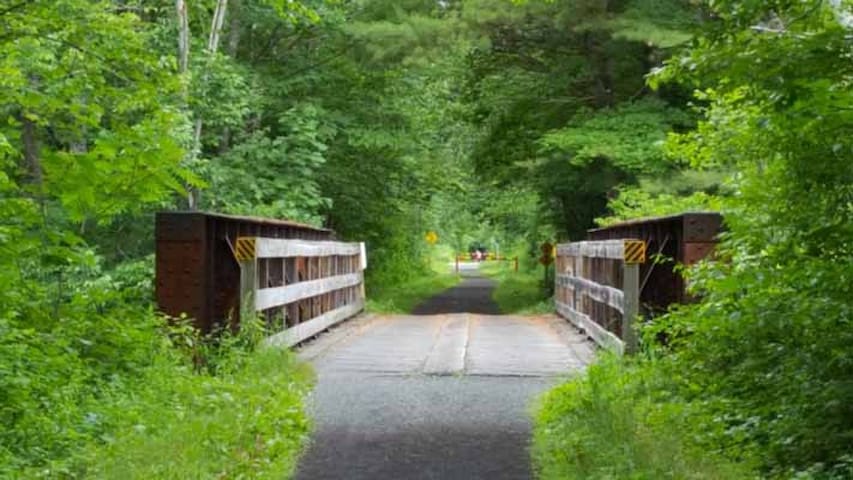
This short, easy trail closely parallels the Mad River, with two stairways up to a height of land offering interesting river views. It also features a footbridge made out of large stepping stones.
Distance: 1 mile (one way)
Time: 30 minutes
The trail begins off the Mad River cross-country ski trail. From Town Square, cross the dam and turn right on the Village X-C Ski Trail, follow the trail through the tunnel, and then turn right on a bridge over Snows Brook. Continue straight over a second bridge, this one over the Mad River.
To the right of where the ski trail rises up the hillside, the Mad River hiking trail heads into the woods. After a small bridge and a series of steep rock steps up to a plateau, the trail walks along the high and steep-sided glacial riverbank. It soon descends steeply on another long series of wooden steps, down to the river’s shore, crosses a rill without a bridge; and then, crosses over a small footbridge, and a larger footbridge at the confluence with the West Branch of the Mad River. The final section easily traces the river and ends at West Branch Road.
https://www.waterville.com/easyhikes/2019/9/16/mad-river-path
Mad River Trail
Mad River TrailThis short, easy trail closely parallels the Mad River, with two stairways up to a height of land offering interesting river views. It also features a footbridge made out of large stepping stones.
Distance: 1 mile (one way)
Time: 30 minutes
The trail begins off the Mad River cross-country ski trail. From Town Square, cross the dam and turn right on the Village X-C Ski Trail, follow the trail through the tunnel, and then turn right on a bridge over Snows Brook. Continue straight over a second bridge, this one over the Mad River.
To the right of where the ski trail rises up the hillside, the Mad River hiking trail heads into the woods. After a small bridge and a series of steep rock steps up to a plateau, the trail walks along the high and steep-sided glacial riverbank. It soon descends steeply on another long series of wooden steps, down to the river’s shore, crosses a rill without a bridge; and then, crosses over a small footbridge, and a larger footbridge at the confluence with the West Branch of the Mad River. The final section easily traces the river and ends at West Branch Road.
https://www.waterville.com/easyhikes/2019/9/16/mad-river-path
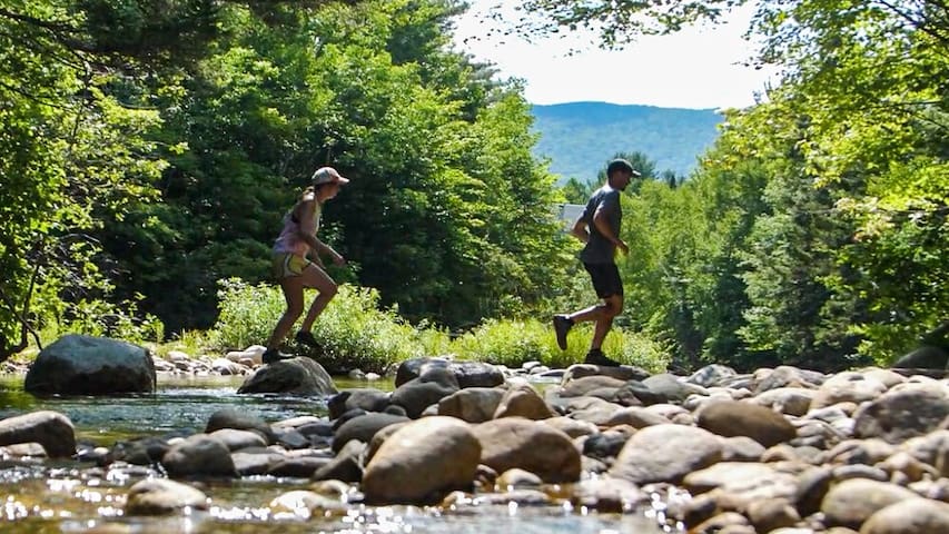
This is a very easy out and back hike that leads to a popular swimming hole just over a mile from Route 49.
Distance: 2.2 Miles (round trip)
Elevation Gain: 230 feet
Time: 40-60 minutes
The trail begins at the southwestern end of the Smarts Brook parking lot, on your left as you head out of Waterville Valley on Route 49, just after Upper Mad River Road crosses the river on your right. From the parking lot the trail turns left and enters the woods on some log steps, joining with an old roadbed. S
oon a cross country ski trail with a blue marker bears to the left. Stay right and follow the trail through a stand of hemlocks until you join with a logging road. Here, the Tri-Town Trail continues straight ahead. To remain on the Smarts Brook Trail, turn left at the intersection on the logging road. After a while, the brook will come alongside the roadbed on your left; and soon after that, you will come to a forest protection area, where there is a popular swimming hole. From here you can enjoy the cool waters then head back the way you came.
If you would like to explore further and make a loop out of it, the upper trailhead of the Tri-Town trail enters 10 minutes up from the pool. The Yellow Jacket Trail diverges left shortly after that on a wooden bridge crossing over Smart's Brook.
Smarts Brook Swimming Hole
Smarts Brook RoadThis is a very easy out and back hike that leads to a popular swimming hole just over a mile from Route 49.
Distance: 2.2 Miles (round trip)
Elevation Gain: 230 feet
Time: 40-60 minutes
The trail begins at the southwestern end of the Smarts Brook parking lot, on your left as you head out of Waterville Valley on Route 49, just after Upper Mad River Road crosses the river on your right. From the parking lot the trail turns left and enters the woods on some log steps, joining with an old roadbed. S
oon a cross country ski trail with a blue marker bears to the left. Stay right and follow the trail through a stand of hemlocks until you join with a logging road. Here, the Tri-Town Trail continues straight ahead. To remain on the Smarts Brook Trail, turn left at the intersection on the logging road. After a while, the brook will come alongside the roadbed on your left; and soon after that, you will come to a forest protection area, where there is a popular swimming hole. From here you can enjoy the cool waters then head back the way you came.
If you would like to explore further and make a loop out of it, the upper trailhead of the Tri-Town trail enters 10 minutes up from the pool. The Yellow Jacket Trail diverges left shortly after that on a wooden bridge crossing over Smart's Brook.
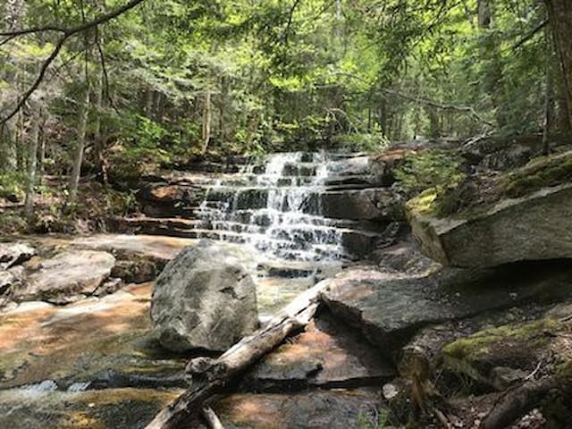
This is an easy out and back trail to a unique section of Slide Brook with scenic rapids and pools.
Distance: 3 miles (round trip)
Elevation Gain: 540 feet
Time: 1.5-2.5 hours
Start your hike at the Snow’s Mountain Parking Lot. Park in the north end of the lot, furthest away from the chairlift. From here you will walk across Cascade Ridge Road to begin the trail. There is a sign marking the trailhead. Next you will walk up a grassy hill following the curves of the road. After entering a wooded section there will be a fork in the trail in front of a large house, you will stay right. The trail continues up the hill and crosses the road before joining an old ski trail on Snow’s mountain.
Continue to follow the trail until it forks again, there will be a Cascade Path sign marking the left path. The trail begins to rise and winds through the forest as you cross the Swazeytown cross country ski trail. From here you will continue uphill for a moment before spending a good distance gently meandering downhill, passing an intersection with the Elephant Rock hiking trail.
1.2 miles into your hike the trail joins with the Lower Snow’s Mountain trail near a small bridge. Take a right and cross the bridge, following the trail for a couple hundred feet until you come to the next bridge. Just before it you will see another Cascade Path sign where the trail branches off to the right.
After 0.2 miles you will come to the first in a series of waterfalls and gorges. The trail splits at the first waterfall, you can hike up either side of the brook. Both sides offer unique and fantastic views of the cascades and the pools below. The trails terminate after 0.3 miles, meeting at a large bridge on the Upper Snow’s Mountain trail.
From here you can continue down the other side of the brook and head back the way you came or you can use the Snow’s Mountain Trail to explore other areas.
https://www.waterville.com/easyhikes/2019/6/11/cascadepath
Cascade Path Loop
Boulder Path RoadThis is an easy out and back trail to a unique section of Slide Brook with scenic rapids and pools.
Distance: 3 miles (round trip)
Elevation Gain: 540 feet
Time: 1.5-2.5 hours
Start your hike at the Snow’s Mountain Parking Lot. Park in the north end of the lot, furthest away from the chairlift. From here you will walk across Cascade Ridge Road to begin the trail. There is a sign marking the trailhead. Next you will walk up a grassy hill following the curves of the road. After entering a wooded section there will be a fork in the trail in front of a large house, you will stay right. The trail continues up the hill and crosses the road before joining an old ski trail on Snow’s mountain.
Continue to follow the trail until it forks again, there will be a Cascade Path sign marking the left path. The trail begins to rise and winds through the forest as you cross the Swazeytown cross country ski trail. From here you will continue uphill for a moment before spending a good distance gently meandering downhill, passing an intersection with the Elephant Rock hiking trail.
1.2 miles into your hike the trail joins with the Lower Snow’s Mountain trail near a small bridge. Take a right and cross the bridge, following the trail for a couple hundred feet until you come to the next bridge. Just before it you will see another Cascade Path sign where the trail branches off to the right.
After 0.2 miles you will come to the first in a series of waterfalls and gorges. The trail splits at the first waterfall, you can hike up either side of the brook. Both sides offer unique and fantastic views of the cascades and the pools below. The trails terminate after 0.3 miles, meeting at a large bridge on the Upper Snow’s Mountain trail.
From here you can continue down the other side of the brook and head back the way you came or you can use the Snow’s Mountain Trail to explore other areas.
https://www.waterville.com/easyhikes/2019/6/11/cascadepath
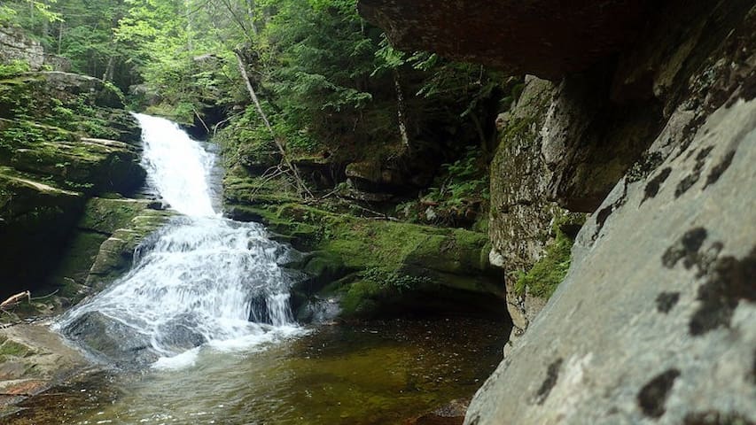
This easy out and back hike heads up the Drakes Brook valley to the Fletchers Cascade, a picturesque series of chutes and ledges that begins on the boggy summit of Flat Mountain. This is a 3.2 mile out-and-back hike and takes approximately 1.5-2 hours.
Distance: 3.2 miles
Elevation Gain: 710 feet
Time: 1:30-2 hours
Park at the Sandwich Mountain Trailhead and begin your hike on the Drakes Brook Trail to the left of the parking lot. The trail gradually winds alongside the river before it splits onto the the Lower Fletchers Cascade cross country ski trail.
At the top of a hill you will then leave the ski trail and take the Fletchers Cascade Trail which angles up along the left-hand side of the brook. Careful foot placement is required as it can be wet in several sections. After entering the Sandwich Range Wilderness, you will cross a stream and ascend a stone staircase. From here the trail becomes steep for a short distance, ascending directly beside the brook.
When you reach a tall rock face the trail will then take a sharp turn to the left which will lead you directly to the waterfall.
Fletcher Cascades
This easy out and back hike heads up the Drakes Brook valley to the Fletchers Cascade, a picturesque series of chutes and ledges that begins on the boggy summit of Flat Mountain. This is a 3.2 mile out-and-back hike and takes approximately 1.5-2 hours.
Distance: 3.2 miles
Elevation Gain: 710 feet
Time: 1:30-2 hours
Park at the Sandwich Mountain Trailhead and begin your hike on the Drakes Brook Trail to the left of the parking lot. The trail gradually winds alongside the river before it splits onto the the Lower Fletchers Cascade cross country ski trail.
At the top of a hill you will then leave the ski trail and take the Fletchers Cascade Trail which angles up along the left-hand side of the brook. Careful foot placement is required as it can be wet in several sections. After entering the Sandwich Range Wilderness, you will cross a stream and ascend a stone staircase. From here the trail becomes steep for a short distance, ascending directly beside the brook.
When you reach a tall rock face the trail will then take a sharp turn to the left which will lead you directly to the waterfall.
Known to locals as one of the most underrated natural features in the White Mountains, the Waterville Flume is a gorge with 60+ foot walls cut into the mountains by Flume Brook.
Distance: 5.4 Miles (round trip)
Elevation Gain: 1,190 feet
Time: 2-4 Hours
To get to The Waterville Flume you will park at the Livermore USFS Fee lot. Take a left on livermore road and begin hiking north for about .9 miles. You will take a left when you see a sign marked Kettle’s Path/Irene’s Path.
Follow Irenes Path for about a mile and as it meanders up one hill, stays flat for a bit, and then climbs sharply up another. Around the top of the second hill you will see a yellow sign marking the spur trail to The Scaur. It is a short steep trail to The Scaur, which offers wonderful views of Waterville Valley, Mount Tecumseh, and the Sandwich Range.
Continue on Irenes path as it climbs Scaur Ridge before dropping down into the next valley on a series of steep switchbacks. Look out for a clearing on one of the corners that offers a northern view of East Osceola and Mad River Notch.
About a mile after The Scaur Spur Trail you will come to a junction with the Old Skidder Trail. Stay left and the Flume is about .2 miles further down the trail.
Flume Peak
Known to locals as one of the most underrated natural features in the White Mountains, the Waterville Flume is a gorge with 60+ foot walls cut into the mountains by Flume Brook.
Distance: 5.4 Miles (round trip)
Elevation Gain: 1,190 feet
Time: 2-4 Hours
To get to The Waterville Flume you will park at the Livermore USFS Fee lot. Take a left on livermore road and begin hiking north for about .9 miles. You will take a left when you see a sign marked Kettle’s Path/Irene’s Path.
Follow Irenes Path for about a mile and as it meanders up one hill, stays flat for a bit, and then climbs sharply up another. Around the top of the second hill you will see a yellow sign marking the spur trail to The Scaur. It is a short steep trail to The Scaur, which offers wonderful views of Waterville Valley, Mount Tecumseh, and the Sandwich Range.
Continue on Irenes path as it climbs Scaur Ridge before dropping down into the next valley on a series of steep switchbacks. Look out for a clearing on one of the corners that offers a northern view of East Osceola and Mad River Notch.
About a mile after The Scaur Spur Trail you will come to a junction with the Old Skidder Trail. Stay left and the Flume is about .2 miles further down the trail.
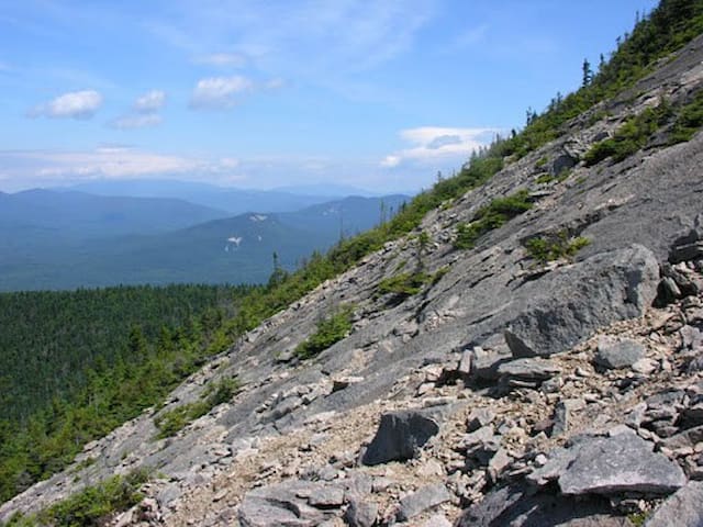
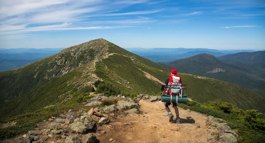
This is a moderate hike that leads to the rocky summits of Welch and Dickey Mountains, offering stunning white mountain views in every direction.
Distance: 4 Miles (Loop)
Elevation Gain: 1,751 Feet
Time: 2-4 Hours
The trail begins at the parking lot off of Orris Road, just past the Gateway condominiums on Upper Mad River Road. Most people hike the trail counter-clockwise, and this description follows that direction.
Bearing right at the beginning, it crosses a brook and traverses the foothills of Welch Mountain, and then begins to ascend by switchbacks, coming out onto "Welch Ledge," which offers a stunning view of the Mad River Valley and the Sandwich Range.
From there, the trail rises more steeply among the rocks, with several difficult passages up the ledges, eventually crossing over the Welch summit, and continuing down into the col between the two peaks.
After a short wooded section of conifers, it ascends steeply up to the Dickey summit, and then traces the rock ledge back into the woods. It gradually descends a mature hardwood forest back down to the parking lot.
https://www.waterville.com/moderate-hikes/2019/6/11/welch-dickey-loop-c7a6k-jgnjj
29 명의 현지인이 추천하는 곳
Welch-Dickey Trailhead
Orris RoadThis is a moderate hike that leads to the rocky summits of Welch and Dickey Mountains, offering stunning white mountain views in every direction.
Distance: 4 Miles (Loop)
Elevation Gain: 1,751 Feet
Time: 2-4 Hours
The trail begins at the parking lot off of Orris Road, just past the Gateway condominiums on Upper Mad River Road. Most people hike the trail counter-clockwise, and this description follows that direction.
Bearing right at the beginning, it crosses a brook and traverses the foothills of Welch Mountain, and then begins to ascend by switchbacks, coming out onto "Welch Ledge," which offers a stunning view of the Mad River Valley and the Sandwich Range.
From there, the trail rises more steeply among the rocks, with several difficult passages up the ledges, eventually crossing over the Welch summit, and continuing down into the col between the two peaks.
After a short wooded section of conifers, it ascends steeply up to the Dickey summit, and then traces the rock ledge back into the woods. It gradually descends a mature hardwood forest back down to the parking lot.
https://www.waterville.com/moderate-hikes/2019/6/11/welch-dickey-loop-c7a6k-jgnjj
This is a moderate out and back trail used primarily to access several other hiking trails and upper Greeley Pond, the source of the Mad River.
Distance: 7.4 miles (round trip)
Elevation Gain: 670 feet
Time: 4-5 hours
The hike to Greeley Ponds begins in the Livermore Road parking lot. Walk past the information stand and fee area and turn left down the gravel path. After a short walk you will reach a small meadow with an intersection. You will then continue straight through the meadow, over a bridge, and back into the woods. Almost immediately after crossing the bridge you will take a left onto the Greeley Ponds Trail.
It starts as an old logging road cobbled with small rocks, comes alongside the Mad River, and continues parallel with the river past the Goodrich Rock Trail on the left after about 30 minutes. Shortly after this you will continue ascending on a gentle grade. The Timber Camp Trail diverges from the Greeley Ponds trail on the left after you have ascended. The Greeley Ponds trail continues, and descends back down to the level of the Mad River, which it crosses on a bridge.
For the rest of the hike to the ponds, the trail stays close to the diminishing river as it ascends the Mad River Notch. There are 6 wooden planked footbridges over rills and run-offs adding to the river; and then the trail descends some log steps and crosses the river (difficult in high water,) at a point where a cross country ski trail continues straight ahead (blazed blue,) The hiking trail enters the Greeley Ponds Scenic Area on the other side of the river, and is wet in several places as it passes to the left of the lower pond.
Stay left as the trail forks and begins to ascend gradually to the upper pond. At the north end of the upper pond a spur path on the right leads down to a small beach. After enjoying the ponds you can head back the way you came, or If you’re feeling adventurous you can follow the trail all the way down the other side to the Kancamagus Highway.
https://www.waterville.com/moderate-hikes/2019/6/11/greeley-ponds
Greeley Pond Trailhead (Kancamagus Hwy)
This is a moderate out and back trail used primarily to access several other hiking trails and upper Greeley Pond, the source of the Mad River.
Distance: 7.4 miles (round trip)
Elevation Gain: 670 feet
Time: 4-5 hours
The hike to Greeley Ponds begins in the Livermore Road parking lot. Walk past the information stand and fee area and turn left down the gravel path. After a short walk you will reach a small meadow with an intersection. You will then continue straight through the meadow, over a bridge, and back into the woods. Almost immediately after crossing the bridge you will take a left onto the Greeley Ponds Trail.
It starts as an old logging road cobbled with small rocks, comes alongside the Mad River, and continues parallel with the river past the Goodrich Rock Trail on the left after about 30 minutes. Shortly after this you will continue ascending on a gentle grade. The Timber Camp Trail diverges from the Greeley Ponds trail on the left after you have ascended. The Greeley Ponds trail continues, and descends back down to the level of the Mad River, which it crosses on a bridge.
For the rest of the hike to the ponds, the trail stays close to the diminishing river as it ascends the Mad River Notch. There are 6 wooden planked footbridges over rills and run-offs adding to the river; and then the trail descends some log steps and crosses the river (difficult in high water,) at a point where a cross country ski trail continues straight ahead (blazed blue,) The hiking trail enters the Greeley Ponds Scenic Area on the other side of the river, and is wet in several places as it passes to the left of the lower pond.
Stay left as the trail forks and begins to ascend gradually to the upper pond. At the north end of the upper pond a spur path on the right leads down to a small beach. After enjoying the ponds you can head back the way you came, or If you’re feeling adventurous you can follow the trail all the way down the other side to the Kancamagus Highway.
https://www.waterville.com/moderate-hikes/2019/6/11/greeley-ponds
The Tripyramid loop is a difficult hike. There are three summits: North Peak [4180 ft.], Middle Peak [4140 ft.], and South Peak [4100 ft.]. There are magnificent views from many points on this trail.
Distance: 10.2 miles
Elevation Gain: 2,903 feet
Time: 5-7 hours
The Mount Tripyramid Loop Trail begins in the Livermore Road parking lot. Walk past the information stand and fee area and turn left down the gravel path. You will follow Livermore Road for quite some time.
As you hike up from the valley, there are two trailheads for Mount Tripyramid. The first, leads to the South Slide. You want the second, half an hour later, at a hairpin turn. It immediately descends down to Avalanche Brook, crosses it, and continues on a long traverse parallel to the brook to the bottom of the North Slide. It's recommended to ascend the North Slide and descend the South Slide, because the North Slide is extremely steep and exposed in sections, and more difficult to descend, especially in wet conditions.
Once on the Slide, the trail is straight up and very steep on slabs and ledge rock. The easiest route is to begin on the left hand side, and angle toward the center and eventually end at the upper right-hand corner of the slide, where the trail re-enters the woods. The views are best before the slide narrows at the end. Once in the woods, there's a short steep section through thick conifers to the summit.
Hiking across the summits is a beautiful undulating route, passing the Sabbaday Brook Trail junction on the left about half way across. Coming down from the South Peak is a short steep section through thick conifers. When descending the South Slide, which is steep, but not so precipitous as the North Slide, the Kate Sleeper Trail diverges to the left almost immediately.
The Mount Tripyramid trail re-enters the woods at the bottom right of the slide. From there, it descends the steep mountainside on a long traverse, eventually joining an old logging road grade running parallel to the Slide Brook, before crossing Avalanche Brook (difficult in high water), just before it rejoins Livermore Road.
https://www.waterville.com/new-blog/2019/6/11/mount-tripyramid
Mount Tripyramid
The Tripyramid loop is a difficult hike. There are three summits: North Peak [4180 ft.], Middle Peak [4140 ft.], and South Peak [4100 ft.]. There are magnificent views from many points on this trail.
Distance: 10.2 miles
Elevation Gain: 2,903 feet
Time: 5-7 hours
The Mount Tripyramid Loop Trail begins in the Livermore Road parking lot. Walk past the information stand and fee area and turn left down the gravel path. You will follow Livermore Road for quite some time.
As you hike up from the valley, there are two trailheads for Mount Tripyramid. The first, leads to the South Slide. You want the second, half an hour later, at a hairpin turn. It immediately descends down to Avalanche Brook, crosses it, and continues on a long traverse parallel to the brook to the bottom of the North Slide. It's recommended to ascend the North Slide and descend the South Slide, because the North Slide is extremely steep and exposed in sections, and more difficult to descend, especially in wet conditions.
Once on the Slide, the trail is straight up and very steep on slabs and ledge rock. The easiest route is to begin on the left hand side, and angle toward the center and eventually end at the upper right-hand corner of the slide, where the trail re-enters the woods. The views are best before the slide narrows at the end. Once in the woods, there's a short steep section through thick conifers to the summit.
Hiking across the summits is a beautiful undulating route, passing the Sabbaday Brook Trail junction on the left about half way across. Coming down from the South Peak is a short steep section through thick conifers. When descending the South Slide, which is steep, but not so precipitous as the North Slide, the Kate Sleeper Trail diverges to the left almost immediately.
The Mount Tripyramid trail re-enters the woods at the bottom right of the slide. From there, it descends the steep mountainside on a long traverse, eventually joining an old logging road grade running parallel to the Slide Brook, before crossing Avalanche Brook (difficult in high water), just before it rejoins Livermore Road.
https://www.waterville.com/new-blog/2019/6/11/mount-tripyramid
Waterville Valley Mercantile
31 Village RdTown Square at Waterville Valley
33 Village RdClubhouse Tubing & Warming Center
3 Lost Pass RdWaterville Estates Community Center
562 Winterbrook Rd사랑이 머무는 곳에
24 Clark Farm RoadAlpine Adventures Outdoor Recreation
45 Main Sthttps://newenglandwithlove.com/things-to-do-in-the-white-mountains-nh/
Franconia Notch State Park is a world all its own. Directly in the heart of White Mountain National Forest, this park has so much to do.
Franconia Notch is a breathtaking mountain pass that can be traversed by driving down the winding I-93, which extends from Flume Gorge to Echo Lake. The famous ‘Old Man of the Mountain’ site is located here, as well as the Kinsman and Franconia mountain ranges, Cannon Mountain Resort and aerial tramway, New England Ski Museum, the Recreational Trail for bike riding, Cannon Cliff for climbing, and the Appalachian Trail. Seriously, you’ll never want to leave Franconia Notch State Park.
100 명의 현지인이 추천하는 곳
Franconia Notch
https://newenglandwithlove.com/things-to-do-in-the-white-mountains-nh/
Franconia Notch State Park is a world all its own. Directly in the heart of White Mountain National Forest, this park has so much to do.
Franconia Notch is a breathtaking mountain pass that can be traversed by driving down the winding I-93, which extends from Flume Gorge to Echo Lake. The famous ‘Old Man of the Mountain’ site is located here, as well as the Kinsman and Franconia mountain ranges, Cannon Mountain Resort and aerial tramway, New England Ski Museum, the Recreational Trail for bike riding, Cannon Cliff for climbing, and the Appalachian Trail. Seriously, you’ll never want to leave Franconia Notch State Park.
Designated as an American Scenic Byway (and one of our top things to do in NH!), the Kancamagus Highway is a 34.5-mile scenic drive along Route 112 that will leave you speechless. This winding road cuts right through the heart of White Mountain National Forest, and no matter what time of year you drive it, your eyes are in for a feast.
In October, the “Kanc” is often considered one of the best places in the country to view some incredible fall foliage. Every bend in the road will reveal sweeping views of the White Mountains, Swift River, gorges and waterfalls, all decorated with brilliant reds, burnt oranges and golds. Traffic is a bit heavier during peak foliage season, so make sure to factor in at least 3 hours to drive the full length.
https://newenglandwithlove.com/things-to-do-in-the-white-mountains-nh/
39 명의 현지인이 추천하는 곳
Kancamagus Highway
Designated as an American Scenic Byway (and one of our top things to do in NH!), the Kancamagus Highway is a 34.5-mile scenic drive along Route 112 that will leave you speechless. This winding road cuts right through the heart of White Mountain National Forest, and no matter what time of year you drive it, your eyes are in for a feast.
In October, the “Kanc” is often considered one of the best places in the country to view some incredible fall foliage. Every bend in the road will reveal sweeping views of the White Mountains, Swift River, gorges and waterfalls, all decorated with brilliant reds, burnt oranges and golds. Traffic is a bit heavier during peak foliage season, so make sure to factor in at least 3 hours to drive the full length.
https://newenglandwithlove.com/things-to-do-in-the-white-mountains-nh/
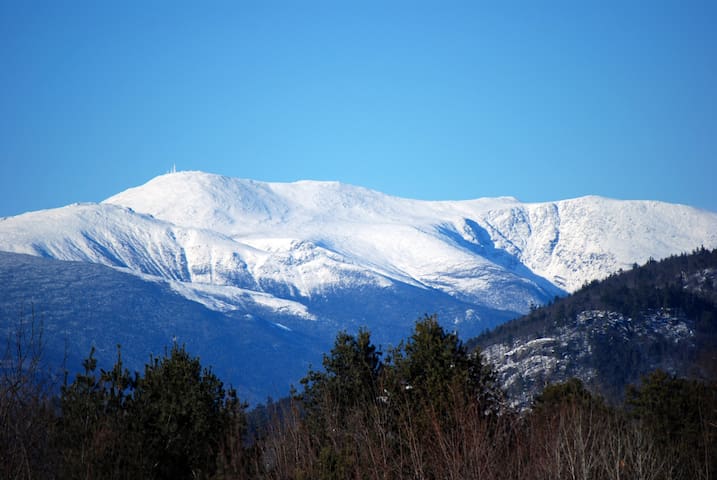
Ah, Mount Washington. The pride and joy of New Hampshire! This 6288’ mountain is the tallest peak in the Northeast and home to the fastest wind gust ever recorded on earth, at 231 mph. It’s also the muse for the famous “This Car Climbed Mt. Washington” bumper sticker.
There are two spectacular ways to explore Mount Washington (besides just hiking it!). Take the historical Mount Washington Cog Railway for an unforgettable train ride to the summit. The Cog has been taking passengers up the mountain for over 150 years now. In less than an hour, this thrilling ride will bring you to the summit, where you can get out and take pictures or just enjoy the sights.
If riding up a steep mountain on a 150-year-old railway isn’t your cup of tea, why not drive your own vehicle? The Mount Washington Auto Road is a scenic road that starts at the base and takes you along a winding path up to the summit. This historic drive is a 7.6-mile ascent that takes roughly 30 minutes, and every bend in the road will offer a unique view of the White Mountains. Keep in mind, there is a toll charge at the base of the road.
https://newenglandwithlove.com/things-to-do-in-the-white-mountains-nh/
11 명의 현지인이 추천하는 곳
Mount Washington
Ah, Mount Washington. The pride and joy of New Hampshire! This 6288’ mountain is the tallest peak in the Northeast and home to the fastest wind gust ever recorded on earth, at 231 mph. It’s also the muse for the famous “This Car Climbed Mt. Washington” bumper sticker.
There are two spectacular ways to explore Mount Washington (besides just hiking it!). Take the historical Mount Washington Cog Railway for an unforgettable train ride to the summit. The Cog has been taking passengers up the mountain for over 150 years now. In less than an hour, this thrilling ride will bring you to the summit, where you can get out and take pictures or just enjoy the sights.
If riding up a steep mountain on a 150-year-old railway isn’t your cup of tea, why not drive your own vehicle? The Mount Washington Auto Road is a scenic road that starts at the base and takes you along a winding path up to the summit. This historic drive is a 7.6-mile ascent that takes roughly 30 minutes, and every bend in the road will offer a unique view of the White Mountains. Keep in mind, there is a toll charge at the base of the road.
https://newenglandwithlove.com/things-to-do-in-the-white-mountains-nh/
Enjoy this 1.30 mile, out and back trail near Intervale, New Hampshire. Generally considered an easy route, it takes an average of 36 min to complete. This is a very popular area for hiking, so you'll likely encounter other people while exploring. Dogs are welcome and may be off-leash in some areas.
https://www.alltrails.com/trail/us/new-hampshire/dianas-baths
244 명의 현지인이 추천하는 곳
다이애나스배스
Enjoy this 1.30 mile, out and back trail near Intervale, New Hampshire. Generally considered an easy route, it takes an average of 36 min to complete. This is a very popular area for hiking, so you'll likely encounter other people while exploring. Dogs are welcome and may be off-leash in some areas.
https://www.alltrails.com/trail/us/new-hampshire/dianas-baths
로스트리버 협곡 및 볼더 동굴
1712 Lost River RoadPolar Caves Park
705 Rumney Rte 25Campton Mountain Ski Area
24 Parker Road스퀌레이크
Squam Lakes Natural Science Center
23 Science Center Rd호보철도
64 Railroad St
Clarks Trading Post Rd, Lincoln, NH 03251 미국
로스트리버 협곡 및 볼더 동굴
1712 Lost River RoadCannon Mountain
Clubhouse Tubing & Warming Center
3 Lost Pass Rd다이애나스배스
Alpine Adventures Outdoor Recreation
45 Main StIndoor Activity
https://www.legendsadventure.com/
Legends Adventure is a family-friendly arcade game room. Use your Freedom Pass to receive $5 free play time! Come play, listen to music, and have fun! Located across from Olde Waterville Pizza Company at Town Square Lower Level.

Legends Adventure
35 Village Roadhttps://www.legendsadventure.com/
Legends Adventure is a family-friendly arcade game room. Use your Freedom Pass to receive $5 free play time! Come play, listen to music, and have fun! Located across from Olde Waterville Pizza Company at Town Square Lower Level.

Legends Escapes
Dole Mill Arcade & Candy Store
1249 New Hampshire Rte 175Castle in the Clouds
455 Old Mountain RdSquiggles' Candy & Gifts
Cute little candy shop, local home décor, and arcade.
Waterville Valley Ice Arena
Cute Ice rink, you can rent skates or bring your own!
Legends Escapes
Plymouth Historical Museum
155 S Main StShopping
Campton Cupboard
1315 New Hampshire Rte 175Dollar General
410 NH-49Walmart Supercenter
683 Tenney Mountain HwyNH Liquor & Wine Outlet
U.S. 302Hannaford Supermarket
50 NH-25Mill Falls at the Lake
281 Daniel Webster HwySightseeing
Plymouth State University
17 High StClark's Trading Post
110 Daniel Webster Hwy호보철도
64 Railroad StMeredith Town
This Pemigewassett River access site is located within the Livermore Falls State Forest. The majority of the land at Livermore Falls State Forest was acquired in 1918 with the purchase of 130 acres. An additional 40 acres was purchased in 1992 with LCIP funding. The LCIP project area has a long history of industrial uses and contains ruins of former pulp mill (1900), a salmon hatchery (1877) and popular recreation sites. Adjacent to the site, but not owned by the state is a lenticular truss bridge (1885).
A parking lot is located on Livermore Road off Route 175. The recreation area offers river swimming, canoe and kayak launching, parking and pit toilets.
https://www.nhstateparks.org/visit/state-parks/livermore-falls-recreation-area
Livermore Falls State Forest Pemi River Access
86 Livermore RdThis Pemigewassett River access site is located within the Livermore Falls State Forest. The majority of the land at Livermore Falls State Forest was acquired in 1918 with the purchase of 130 acres. An additional 40 acres was purchased in 1992 with LCIP funding. The LCIP project area has a long history of industrial uses and contains ruins of former pulp mill (1900), a salmon hatchery (1877) and popular recreation sites. Adjacent to the site, but not owned by the state is a lenticular truss bridge (1885).
A parking lot is located on Livermore Road off Route 175. The recreation area offers river swimming, canoe and kayak launching, parking and pit toilets.
https://www.nhstateparks.org/visit/state-parks/livermore-falls-recreation-area
미국 03259 뉴햄프셔 워터빌 밸리 사바데이 폭포
Fields
The Pemi Soccer Field
1310 New Hampshire Route 175Plymouth Parks & Recreation
6 Post Office Square